...Best of Sicily presents... Best of Sicily Magazine. ... Dedicated to Sicilian art, culture, history, people, places and all things Sicilian. |
by Vincenzo Mormino | |||
Magazine Index Best of Sicily Arts & Culture Fashion Food & Wine History & Society About Us Travel Faqs Contact Map of Sicily
|
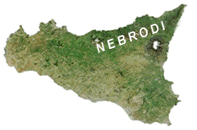
The extensive Nebrodi region (a protected reserve) is larger than the Madonie, making up in expanse and forests what it lacks in height. Like the Peloritans, the Nebrodi constitute part of a "continental divide," actually a continuation of the Apennines, which extends from the Alps along the Italian Peninsula across the Mediterranean into Tunisia, bordering the volcanic foothills of towering Mount Etna - itself a geological afterthought. In effect, the Apennines divide the Meditarranean in half along a north-to-south axis. The presence of the Nebrodi makes most streams in central Sicily flow southward and (generally) eastward. Historically, the Nebrodi constituted a Greek, Roman and Norman gateway to western Sicily. They may have arrived by sea, but the land itself had to be conquered, and this was rarely an easy task. In 1943, American and German troops contended bloodily for control of points in the Nebrodi as the latter retreated toward the Strait of Messina. The older towns of the Nebrodi are of Byzantine Greek foundation, sometimes built on or near Roman-era settlements,
and the Eastern (Orthodox) Church was strong here into the thirteenth century. A number of Byzantine monasteries dot the Nebrodi. It may be observed that, in a very
general sense, the populations of the Peloritan and Nebrodi regions remained largely Siculo-Byzantine in the Middle
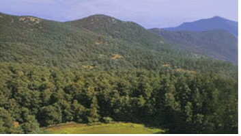
Ages, while the nearby Madonie and Erei regions were Etna and the Madonie have their woods, of course, but Sicily's most extensive forests are to be found in the Nebrodi (sometimes called the Caronie). Wild cats, porcupines, hares, foxes, weasels, snakes, lizards and birds of prey still thrive in certain parts of the Nebrodi. Following heavy rains, giant toads come out of their niches. The San Fratello horse and the Nebrodian black swine are typical domestic livestock of the region, which has its own particular Nebrodian cuisine. The so-called "Sicilian Fir" (Abies Nebrodensis) once carpeted the highest parts of the Nebrodi, but surviving specimens exist only in the neighboring Madonie. The flowering Manna Ash (Fraxinus Ornus) and other trees, such as oaks and mountain ash, will still be found. The Catafurco Falls and Ancipa (Sartori), Maulazzo and Trearie lakes (the last is naturally formed) are just a few of the interesting natural attractions. The Crasto Rocks, a series of mini-canyons near the Byzantine-Norman towns of San Marco d'Alunzio and Alcara Li Fusi, are also worth a visit. People who visit Sicily believing there are no forests on our island haven't been to the Nebrodi. To paraphrase Goethe, "To have seen Sicily without having seen the Nebrodi is not to have experienced Sicily at all." About the Author: Vincenzo Mormino has written about wildlife and nature for Best of Sicily and hard-copy publications. | ||
Top of Page |
 The Nebrodi Mountains, whose name traces
its origin to that of a particular species of Sicilian deer (now extinct), range from the ruggedly scenic Peloritan
Mountains (which extend from the area north of Etna to Messina) across northeastern Sicily toward the valleys leading to
the foothills of the
  more influenced by Arab settlement and culture. In the
1060s, when Norman incursions were contested in the Nebrodi region, it was by Sicilians of Greek orientation, sometimes
in league with Saracens (Arabs). Troina, Nicosia and Mistretta are the more prominent towns.